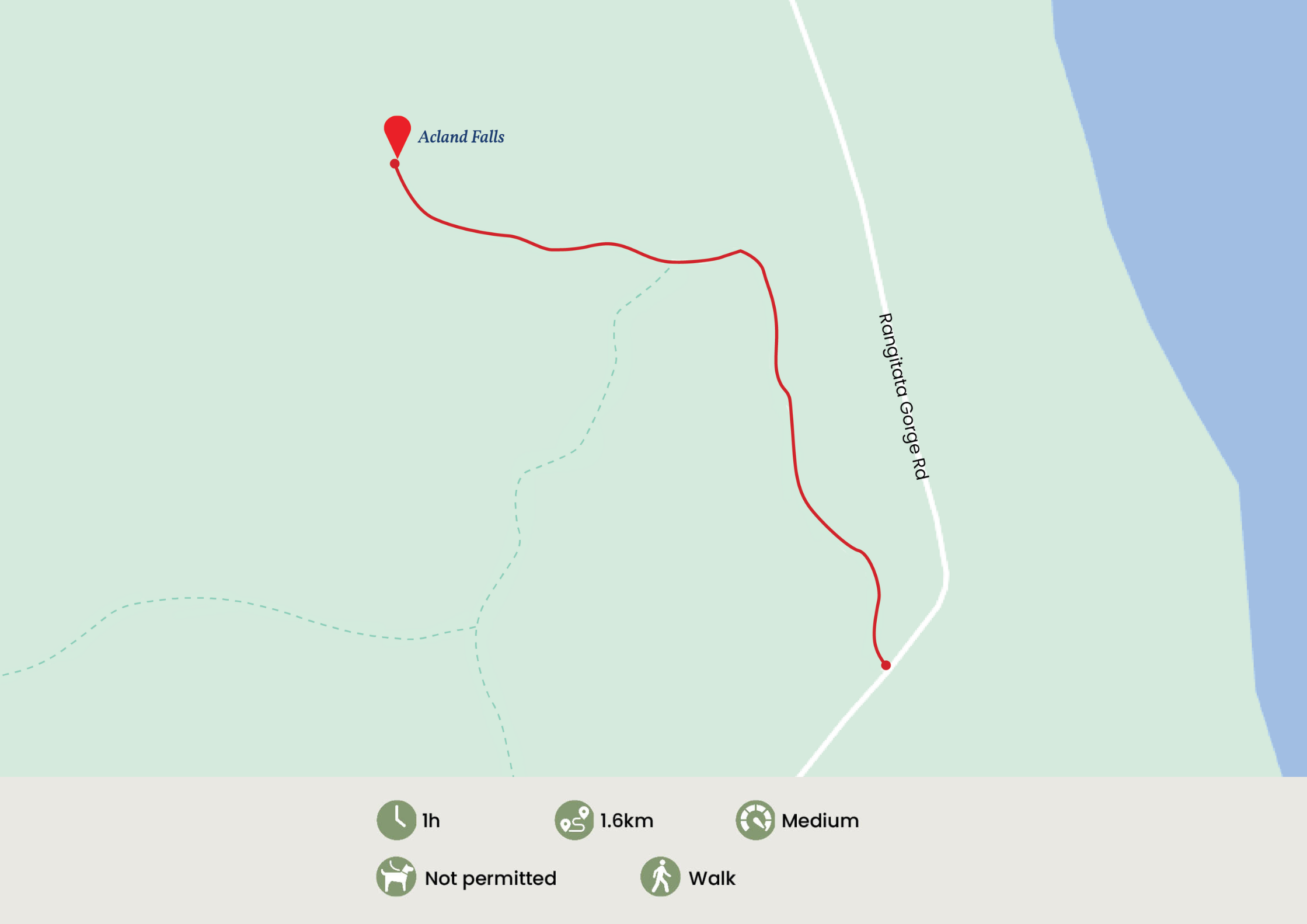
Acland Falls
Track Description
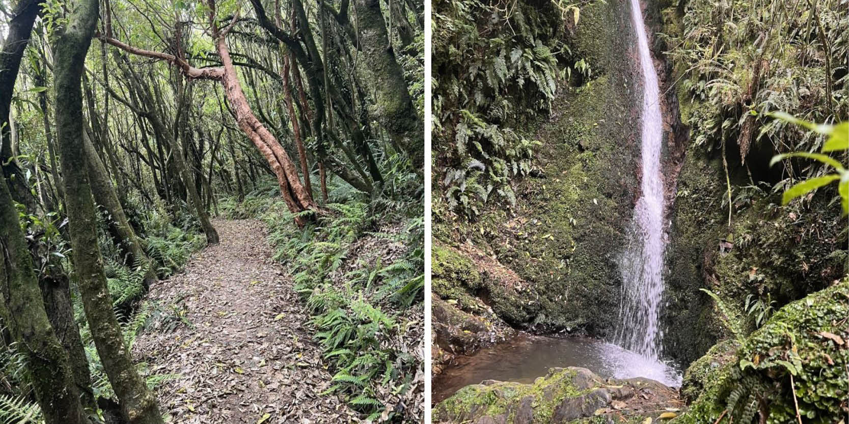
The track climbs steeply and then drops into a small stream. The falls (14 m), a short walk up the stream bed, are named after J B Acland of Mt Peel Station. The sunnier and drier aspect of this northern flank of the park has produced vegetation strikingly different from that found elsewhere, dominated by fuchsia, māhoe, kōwhai and kānuka.
Getting There
From Geraldine town centre, take SH79 north out of town and over the Orari River Bridge. Keep left as you come off the bridge and follow along the Inland Route 72 for 3kms before turning left onto Peel Forest Road. Stay on Peel Forest for approximately 15 kilometres. There is parking available across the road from the start of the track at the Peel Forest Department of Conservation Campground.
Download Acland Falls Track map