Mt Nimrod
Track Description
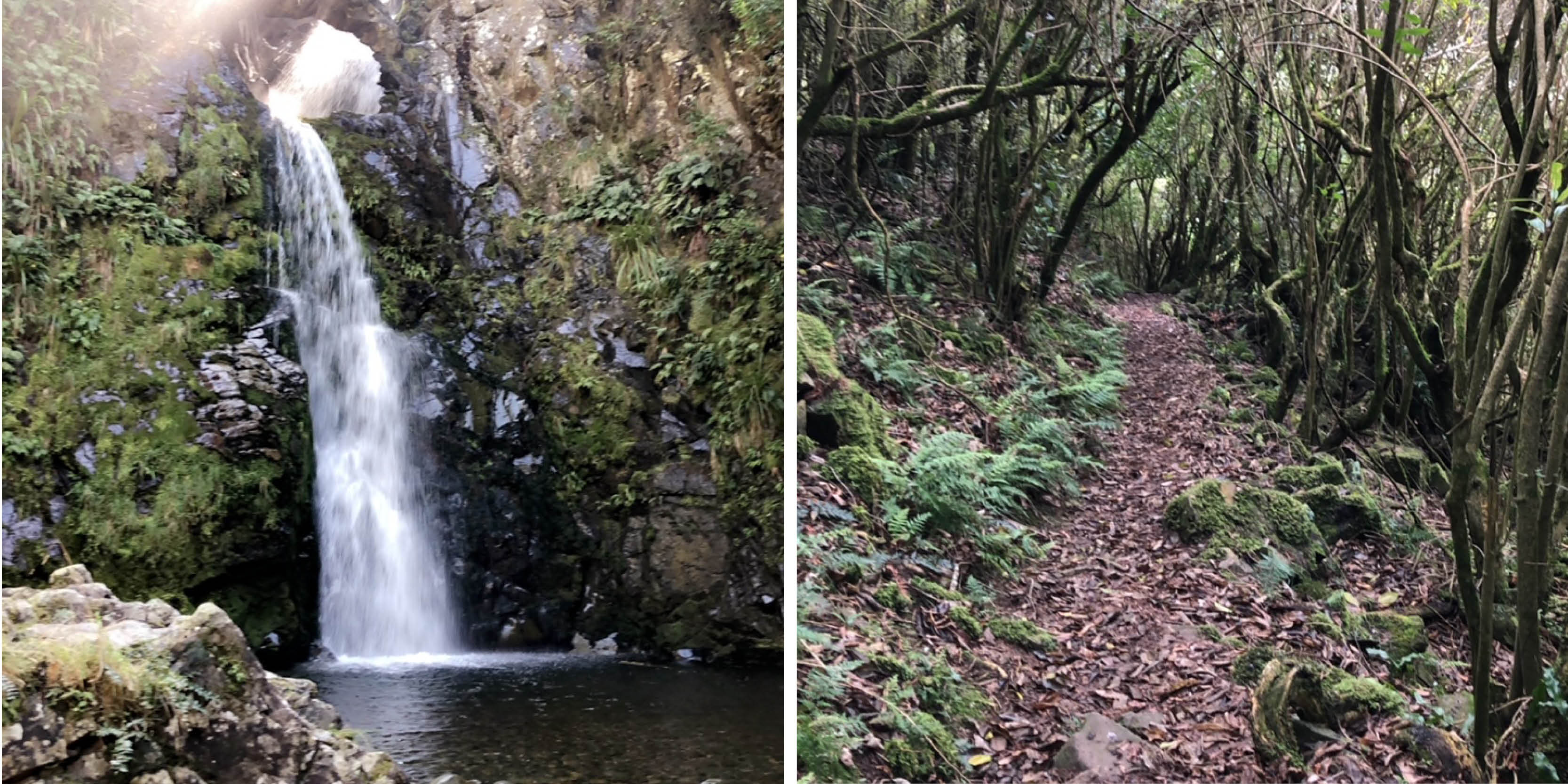
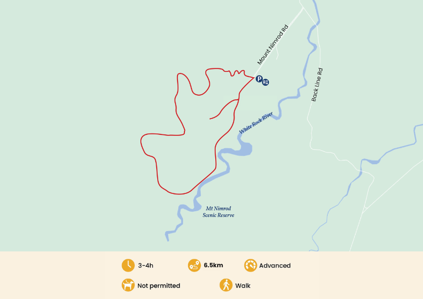
This track has great views and a waterfall that plummets through a rock arch. From the campground, take the bridge across Nimrod Stream where the loop track takes you on an anti-clockwise circuit of the reserve. Initially it climbs steeply up out of the forest to a lookout point which gives good views out to the coast.
Getting There
To get here from Timaru follow Beaconsfield Road turn left on to Holme Station, then turn right on to Pareora River Road. Turn left on to Craigmore Valley Road, turn right on to Timaunga Road and then left on to Elders Road. Turn right on to Back Line Road and stay on this road until you reach Mount Nimrod Road, turn left and the camp and parking area is at the end of this road.