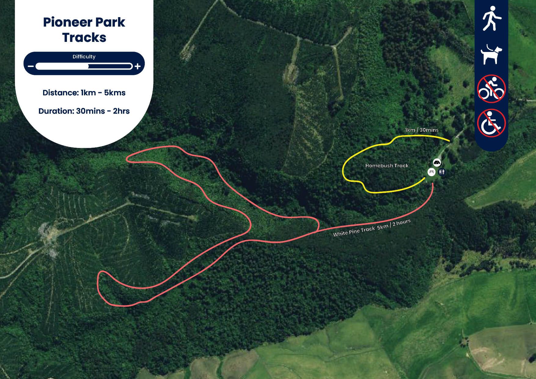
Pioneer Park Tracks
Track Description
Homebush Track
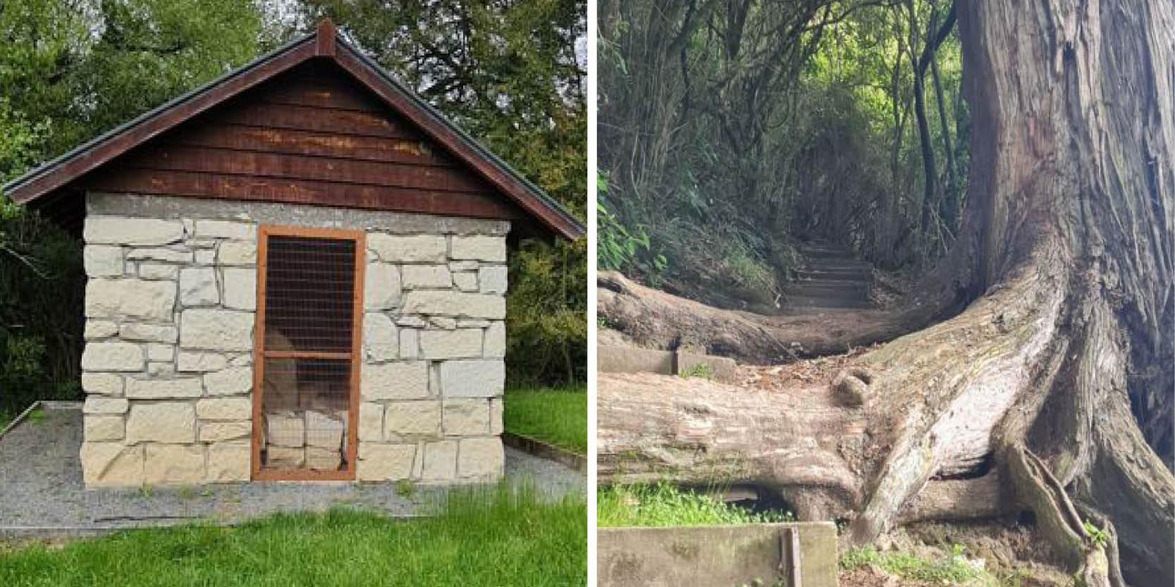
This loop track starts from the campground, crossing a small stream and then gently climbing to a ridge where there are large kaikahikatea and tōtara. The most impressive is a stately tōtara about three metres in diameter. The track then returns via the Burke Hut memorial.
White Pine Track
This track starts from the campground and climbs through regenerating native bush and then through introduced forestry trees. The return leg drops steeply into a native bush gully and zigzags (several times) across the stream before meeting the original track. A left turn takes you back to the campground.
Getting There
From the Pleasant Point township, turn onto Tengawai Road and stay on here for 2.5 kilometres and turn left onto Totara Valley Road. Continue on Totara Valley Road for approximately 8.5 kilometres then turn right onto the Raincliff Road. Stay on Raincliff Road for 6.7 kilometres where the road veers right onto Middle Valley Road. Travel along Middle Valley Road for 4.2 kilometres and turn left onto Homebush Road. At the end of Homebush Road is the Pioneer Park Campsite where both walks start from.
Download Pioneer Park Tracks map